Santiago Peak
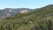
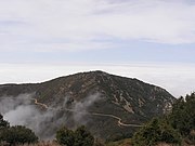
Mountain in California, USASantiago Peak is the southern mountain of the Saddleback landform in Orange County and Riverside County, California. It is the highest and most prominent peak of both the Santa Ana Mountains and Orange County. The peak is named for Santiago Creek, which begins on its southwestern slope. During most winters, snow falls at least once on the peak. A telecommunication antenna farm with microwave antennas sits atop the peak.
Read article
Top Questions
AI generatedMore questions
Nearby Places

Santa Ana Mountains
Mountain range in California, United States

Saddleback (Orange County, California)

KWVE-FM
Christian radio station in San Clemente, California, United States

Modjeska Peak
Peak in the Santa Ana mountain range
Trabuco Canyon National Forest
Holy Jim Volunteer Fire Department
Firefighter group in Orange County, US

Holy Fire (2018)
2018 wildfire in Southern California
Joplin Youth Center
Juvenile center in Orange County, California


